Man with a Plan
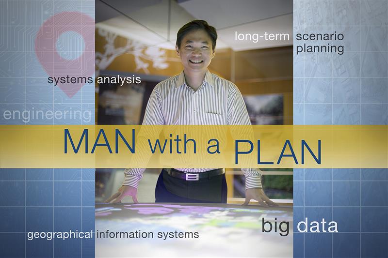
What do you do as a systems analyst?
My role is to implement enterprise Information Technology (IT) systems as well as to develop advanced digital planning tools. These tools will enable urban planners to make more informed decisions and consider various options. For example, planners will be able to identify the demographics of a particular area with more precision and plan for suitable amenities and facilities there.
As systems analysts, we actively look into the innovative use of IT and software tools that can improve business processes, public services and productivity. We also look at IT governance matters to ensure our systems and data are secured and well-protected.
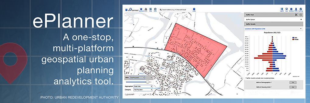
URA has a system called the ePlanner which allows for advanced spatial visualisation and analytics. Tell us about this geospatial urban planning portal.
ePlanner is a one-stop, multi-platform, geospatial urban planning analytics tool developed in-house. It integrates data from various sources to enable advanced spatial visualisation and analytics. Through effective data analytics and visualisation, ePlanner makes complex GIS and Big Data analytics very intuitive and user-friendly for all planners. ePlanner also enables planners from various agencies to access and analyse various land-use planning information such as zoning and development control parameters. It only takes a few clicks and can be accessed even when they are on-the-go.
ePlanner translates large amounts of data from multiple sources into useful planning insights through geospatial data analytics, to facilitate a more data-driven and evidence-based planning. It enables planners to better understand the ground situation and to anticipate changes. By working on a common analytic platform, agencies can better share up-to-date information and make collective planning decisions. It is currently being used by more than 25 agencies including the Housing Development Board, the Ministry of National Development, the Ministry of Health and the Ministry of Home Affairs.
Another digital planning tool that I am currently developing with my colleagues is the GIS-Enabled Mapping, Modelling & Analysis (GEMMA) platform, which uses advance spatial analytics for long-term scenario planning. It is one of the most interesting and challenging projects that I have undertaken so far.

Why is this so?
GEMMA enables planners to compose multiple land use scenarios quickly, through a suite of apps that tracks urban development staging easily. It allows planner to search and select sites quickly, and jointly evaluate scenario outcomes and potential impact on supporting infrastructure (e.g. transport) with partner agencies.
There are no similar off-the-shelf technologies or tools. That is why we decided to develop the planning app in-house. Instead of traditional enterprise IT, we use an agile product life-cycle development approach; conceptualise business ideas into technical requirements; and break the product down into interactive parts and modules with rapid prototyping. We also researched a lot on suitable technologies and put the working modules together.
There was an immense sense of satisfaction when the beta was implemented and from knowing that this tool would also be used by various land agencies working on long-term strategic planning.
How did you get into this field?
The dot-com boom in the 1990s got me very curious about computer and software programming so I decided to study computer engineering at Nanyang Technological University. I love to solve math and science questions, and I think I am a logical thinker too. Computer engineering was an obvious choice for me. I am thankful that URA provides opportunities to explore new exciting technology to tackle planning issues and shape the future land use planning of Singapore.
Complete this sentence: As a computer engineer, I…
…I explore the use of IT to solve business issues and create impact to the organisation. The systems that I have developed with my colleagues have changed the way URA’s planners work, which translates to the shaping of Singapore’s urban landscape today and in the future.
To learn more about engineers in the Singapore Public Service, visit Engineer What's Next.
- POSTED ON
Apr 11, 2016
-
Profile
What If My Best Is Average?
-
Deep Dive
Seeing Risk Differently


