


Into The Depths Of Our Waters With MPA Hydrographers

It is 9am, and we are setting off from Shell Jetty, a quiet private pier off Pasir Panjang Drive.
Mr Wong Tuck Meng, a hydrographer at the Maritime and Port Authority of Singapore (MPA), dons a pair of wraparound sunglasses. He strides across a docked boat and onto the Lita Investigator, a vessel equipped for hydrographic surveys.
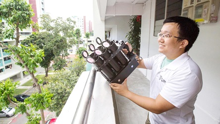
To keep ships safe in Singapore’s waters, MPA hydrographers use precise technology to collect data of sea depths and the shape of the seabed. This data is processed and passed on to MPA cartographers, who further refine and chart the information on marine navigational maps.


Hydrographic surveying is a job Mr Wong, 57, fell into “by chance”, he says. But it is clear that he takes pride in his work. He marvels at the latest technology for hydrography. In his 34 years on the job, Mr Wong has seen huge changes: it used to take five men, collecting data by hand, nearly three days to do the same work that a “one-man show” can now do in half a day.
Mr Wong has taken on more of a mentor’s role now, going out to sea every two or three months. Joining him today is 26-year-old Assistant Hydrographer Choo Jun Gang. Mr Wong shows him interesting points, such as the shallower parts of the seabed, as data streams across two monitor screens set up in the boat.
.jpg "5-6 (1)")
Right: Back at the MPA headquarters at Tanjong Pagar, Mr Wong has lunch from 1pm to 2pm. He prefers to take away his food and have the hour to himself in his cubicle, reading the newspapers at the same time, Mr Choo tells Challenge.
.jpg "7-8 (1)")
Bottom: These are scans of World War II shipwrecks discovered in 2012, in Singapore waters.
The MPA also ensures that seabeds are not too cluttered with objects left behind. “Ships that drop their anchors can get the chains stuck in the rubbish. Not being able to lift the anchor, the ships just cut it off , creating more rubbish,” says Mr Wong, Principal Technical Executive. The MPA will arrange for such debris to be removed if necessary.
In their surveys, MPA hydrographers have found wrecks of abandoned vessels. Dolphins are also a common sight in local waters. Mr Wong thinks he even saw a whale once, while in more open waters. “I saw something come up, a sprout of water, and something go down again,” he says, grinning. “But no one believed me.”
- POSTED ON
Jan 5, 2016
- TEXT BY
Siti Maziah Masramli
- PHOTOS BY
Norman Ng
-
-
 nofilter
Tunnel Vision
-

-

-
 Deep Dive
In Blockchain We Trust
-
 Trends
Trending February 2018