What Will It Take For Singapore to Go 'Car-Lite'?
.jpg)
When Transport Minister Khaw Boon Wan announced a year ago that the upcoming North-South Expressway would be redesigned to include dedicated cycling paths and express bus lanes, the news was greeted with delight.
To observers, it was a clear indication that the government was matching its words with concrete moves towards creating a “car-lite” culture in Singapore, where walking, cycling and riding public transport would be the way of life.
Set for completion by 2020, the 21.5km expressway will link housing estates in the north like Ang Mo Kio and Woodlands to the city centre. Built partially underground, it will also have walking paths along the corridors above ground.
In the right direction
Prime Minister Lee Hsien Loong was among the first to speak of a “car-lite Singapore” when in 2014, he unveiled the Sustainable Singapore Blueprint, a $1.5 billion, 15- year plan for the nation to cut its dependence on cars and move towards more sustainable modes of transportation.
But why? For one, Singapore’s population is projected to grow to about 6 million by 2020, from about 5.6 million currently. With the rising population, transportation needs will also increase. Yet, as land supply remains limited, cars aren’t the solution.
Creating more roads and parking lots would be “neither feasible nor sustainable for land-scarce Singapore”, the Urban Redevelopment Authority (URA) wrote in its report Designing Our City in 2013.
It’s also about making Singapore a more liveable place. “There is a growing consensus among developed cities that fewer cars mean less traffic congestion, less air and noise pollution, and more land for public spaces and amenities,” wrote Mr Khaw in a January 2016 blog post.
Cities designed for walking and cycling also create a better quality of life for their residents, who gain the health benefits of exercise and a stronger sense of community. Being a world-class liveable city would help Singapore to attract more talent too.
All systems go
No wonder then that many initiatives are being put in place to encourage a car-lite culture, starting with infrastructure for transport and new towns.
The Ministry of Transport is expanding the public transport system. For instance, by 2030, the rail network will double to 360km with the addition of new lines (the Cross Island Line and Jurong Region Line), as well as extensions to the existing Circle, North East and Downtown lines.
The goal? That 75% of trips will be made by public transport by then, and 85% by 2050.
There are also streets redesigned to be more car-lite, such as Bencoolen Street, which now has two out of four lanes turned into cycling and walking paths.
Then there is the future “Forest Town” of Tengah, the 24th Housing & Development Board town. Tengah will have Singapore’s first car-free Town Centre, with vehicles running underground beneath the pedestrian- and bikefriendly centre, designed amid a lush park. All roads in the rest of Tengah will have dedicated walking and cycling paths, and accommodate for self-driving vehicles too.
Encouraging active mobility
Plans are afoot to improve and develop other infrastructure too, such as the building of 700km of cycling paths in a national cycling network by 2030 – in a bid to encourage more people to cycle, and cycle safely.
Singaporeans are warming to the idea of cycling as a form of commute. An upbeat Mr Francis Chu, co-founder of cycling enthusiast group LoveCyclingSG, has noticed more Singaporeans taking to their bikes in recent years: “We have observed a lot more bicycle parking spaces introduced over the last couple of years, and most of the spaces are well used. This indicates that bicycle use of first/ last-mile purposes has increased multiple times.”
He also pointed to anecdotal evidence from his group’s Facebook page, where more people are asking for tips on cycling to work or to school. “This shows there is a clear increase of interest to use the bicycle as a mode of transport.”
In recent years, Singaporeans have begun cycling a lot more on both roads and pathways – so much so that the government has set up an Active Mobility Unit (AMU) within the Land Transport Authority (LTA). The AMU oversees all walking- and cycling-related policies and initiatives in Singapore.
Government policies now include new rules on the use of footpaths and shared/cycling paths, introducing speed limits, as well as size and weight restrictions for devices. Personal mobility devices (PMDs) for example are now allowed on footpaths and shared paths, with speed limits of 15km/h and 25km/h respectively. PMDs are currently also allowed on public transport in a six-month trial starting from December 2016.

—Mr Khaw Boon Wan, in a January 2016 blog post
Cities driving change
These are the trailblazers that are pushing for car-free neighbourhoods, so that work commutes and daily life are made more pleasant.
Mobility on demand in Helsinki, Finland
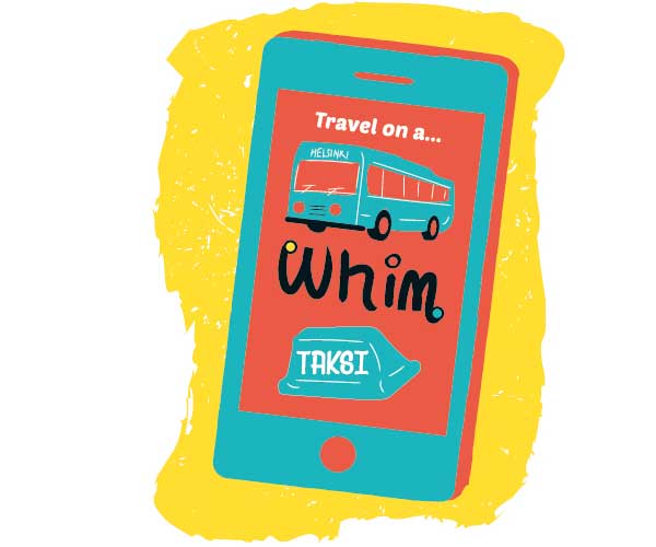
The Nordic capital is not immune to gridlocks. Yet, even with a population expected to grow by 50% by 2050, Helsinki continues to be a pioneer in sustainable transport. Its planners want to make the city centre car-free by 2025. Innovative strategies, besides an efficient public transport system and dedicated bicycle lanes, have helped to make that dream a reality. New initiatives include a Kutsuplus (“Call plus”) minibus service with routes determined by bookings. A new mobility-on-demand service app called Whim, created with city planners and slated to launch in early 2017, will let users have a combination of public transport, bicycle sharing, taxis and rental cars to get to their destination for a monthly fee.
Autonomous vehicle trials in Singapore
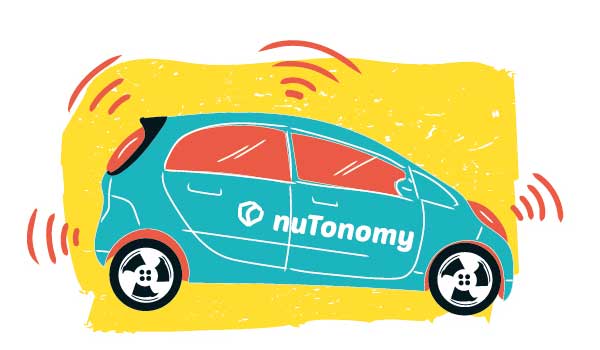
The city-state has already kick-started several experiments in autonomous driving and is one of the first dedicated test-beds for the technology in the world. The Ministry of Transport will be testing the use of driverless trucks, or “truck platooning” technology, for moving cargo between port terminals with port operator PSA. The world’s first self-driving taxis also started plying the streets in One North in a limited trial operated by start-up nuTonomy, with the goal of a fully autonomous fleet by 2018. There are also plans to trial self-driving electric-hybrid buses that ferry commuters between Nanyang Technological University and Pioneer MRT station in a tie-up between the Land Transport Authority and the university.
Cycling superhighways in Copenhagen, Denmark
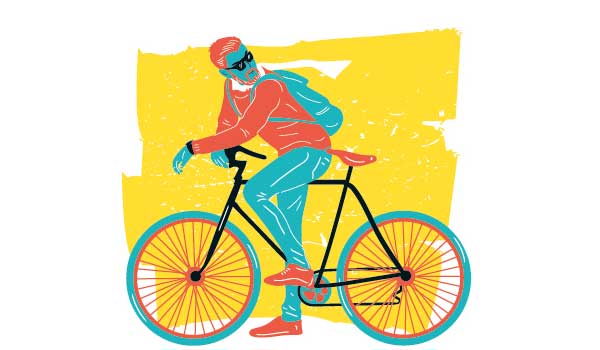
The world’s first cycling city is a model to many countries, with more than half of its population cycling to work every day and one of the lowest car ownership rates in Europe. Since 2005, 1 billion Danish kroner (S$203 million) has been invested in cycling infrastructure – including over 200 miles (about 322km) of bicycle lanes – and systems such as bike-hire schemes. Prominent are the safe and continuous bike superhighways, such as the elevated two-lane Cykelslangen (the Cycle Snake) that connects the highway and harbour bridge and is built over water. City planners have developed a Cycle Track Priority Plan for 2017–2025, with data culled from users on bike lanes that can be improved.
Pedestrianising roads in central Madrid, Spain
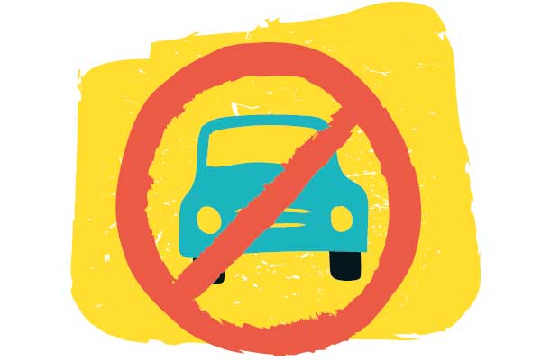
In December 2016, Madrid closed its entire city centre to most cars for nine days over the holidays, allowing only buses, taxis and residents’ cars (and only at a lowered speed limit). This is just one step in a larger plan to completely pedestrianise central Madrid in the next three years. Among the initiatives: 24 busy streets are being redesigned for walking only; carparks are being built outside the car-free zones, making it easier for drivers to use public transport there; a fleet of 2,000 clean electric buses by 2020; and temporary driving bans during winter pollution peaks.

.jpg)

To further encourage cycling, public bike-sharing programmes are in the pipeline, such as a pilot scheme for the Jurong Lake district in 2017 starting with 1,000 bikes and 100 docking stations.
And since July 2016, property developers must factor in the needs of pedestrians and cyclists in their designs, such as the locations of bicycle parking facilities and vehicular access points.
Speed bumps ahead
Although Singapore’s car-lite strategy is being stepped up and moves are already in place to build the hard infrastructure, many loose ends still need to be tied up.
For the private sector, challenges abound, especially in mature commercial districts like Orchard Road. These require more innovative solutions that suit the existing infrastructure with their old building codes, as well as resolving decades-old problems, such as inefficient logistics set-ups.
Mr Steven Goh, the executive director of the Orchard Road Business Association, said: “To be frank, we require a lot more hand-holding from the government. It’s not easy to incorporate car-lite features into Orchard Road’s existing developments, unlike new developments. No landlord is going to do such initiatives because of the cost factor.”
Only one developer there, Shaw Organisation, has begun thinking green, by fitting in new public shower facilities and bike racks, he pointed out.
“Unfortunately, we need government initiatives to overcome this inertia,” he said.
Mr Goh suggested that the government review existing building codes and give more incentives to developers. One idea is to sacrifice compulsory carpark lot requirements and allow developers to convert the empty lots into community space instead, enhancing the appeal of Orchard Road as a lifestyle destination.
With two more MRT lines due to open by 2020 in the Orchard area, visitors will have even more public transport options and it is expected that fewer drivers will be using their cars to get there. “All the more, the government should relook carpark requirements,” he said.
Changing minds and behaviour
To get more people using public transport instead of cars, the LTA is making the first and last mile of the commute, such between home and MRT stations, even more comfortable and convenient.
The LTA’s Walk2Ride Scheme to build sheltered linkways near public transport nodes is “expanding at breakneck speed”, said its Director of Local Planning Kenneth Wong.
A car-lite Singapore by the numbers
.jpg)
89.2 sq km
Transport infrastructure takes up 12% of Singapore’s land area, or 89.2 sq km, almost as much as land allocated for housing (14%).
15 towns
Dedicated cycling paths in 15 towns by 2020.
700km
A 700km National Cycling Network to be built by 2030.
360km
By 2030, the rail network will double to 360km with the addition of new lines, the Cross Island Line and the Jurong Region Line, as well as extensions to the Circle Line, North East Line and Downtown Line.
75%
By 2030, 75% of all peak-hour journeys will be made on public transport and 8 in 10 homes will be within 10 minutes’ walking distance of a train station.
“We have about 20km of sheltered walkways today and we expect to complete 200km by 2018. We’re already seeing the fruits of the first 20km. Commuters have given feedback that rain or shine, they are useful,” he said at the Creating Liveable Cities through Car-Lite Urban Mobility Lecture, organised by the Centre for Liveable Cities (CLC).
When it comes to building infrastructure, he added: “Some may say it’s too much, but it is an important piece.”
There is also the growing popularity of ride-sharing and carpooling apps such as RYDE and Uber.
RYDE saw its membership grow five times over the past year while requests increased tenfold, to more than 100,000 monthly. Mr Terence Zou, the founder and CEO of RYDE Technologies, said: “There is tremendous demand for carpooling in Singapore… Innovation can help us solve our present problems using better ideas and better technology.”
In July 2016, 21% of all Uber trips that began or ended near an MRT station used its UberPool service. It has “become a popular transport option that complements public transit”, said Mr Warren Tseng, General Manager of Uber Singapore. New “demand hotspots” are opening and expanding from the Central Business District (CBD) to heartland areas such as Woodlands, Choa Chu Kang, Pasir Ris, Bedok and Jurong.
One of the biggest challenges is weaning car-loving Singaporeans off cars. Today there are about 552,427 private cars in Singapore, an eight-year low. Rental car numbers, on the other hand, grew 75% to an all-time high of 51,336, bolstered by the entry of ride-hailing services Uber and Grab in 2013.
Yet discouraging car use by developing the next phase of Electronic Road Pricing or increasing the cost of Certificates of Entitlement can only go so far.
The decentralisation of commercial activities is a key land-planning strategy to reduce car use. With regional centres in Punggol, Novena, Paya Lebar, Woodlands and Jurong creating workplaces closer to homes, more people can choose to go to work using public transport or PMDs. Singapore’s plans for decentralisation began as early as the 1990s, with the 1991 Concept Plan Review.
Another way to start a shift in mindset has been through creating car-free events, such as Car-Free Sunday SG (see sidebox). Held by the URA, the event aims to let participants enjoy the benefits of a car-free environment.
To grow a car-lite culture here in Singapore, what it may boil down to is putting the needs of the people first, and giving them mobility options in a safe, inclusive environment, particularly in the face of rising sustainability and liveability concerns.
Mr Scott Dunn, Vice-President of engineering firm AECOM and former Council Chair of the Urban Land Institute Singapore, said at the CLC Lecture: “If you start thinking of people first, then the whole network becomes more about moving at ground, through the urban environment, creating weather protection and getting around easily and conveniently to that place where people want to go.”
As the LTA’s Mr Wong put it: “We aspire to create a culture where everybody actively walks, cycles and rides public transport. It’s also about giving people options [like] taking the taxi or car sharing, and creating a safe inclusive environment for all.”
The spark for Car-Free Sunday SG
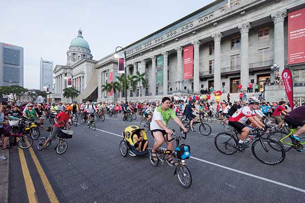
Singapore’s first large-scale car-free zone project would not have been possible if not for the determination of Mr Nicholas Li and his colleagues.

Nicholas Li
“We went out to engage stakeholders, and we walked all over Club Street to get the restaurants’ buy-in.”
An executive architect with the Urban Redevelopment Authority (URA), Mr Li first proposed creating car-free zones during a brainstorming workshop in 2012, to demonstrate how streets without cars can feel like. Together with other URA colleagues, he was tasked to turn the idea into reality, starting with Club Street and Ann Siang Road, near the URA Centre.
“It was challenging for us in the beginning,” says Mr Li. “We went out to engage stakeholders, and we walked all over Club Street to get the restaurants’ buy-in.”
Their hard work paid off though. In March 2013, the first Car-Free Zone pilot project was launched. The successful pilot project at Club Street and Ann Siang Road inspired the creation of nine other road closure projects around the city, many driven by local stakeholders in consultation with the URA.

Mr Li also noticed successful carfree events elsewhere and took part in one in Kuala Lumpur in February 2014. The KL event had extensive road closures in the city, creating a 7km long cycling track for the public to enjoy on Sunday mornings.
Mr Li proposed bringing this idea of closing roads for walking, jogging and cycling to Singapore’s Civic District and CBD, where major streets are generally under-utilised on Sunday mornings. With his management’s support, he raised his proposal at inter-agency dialogues, and was able to rope in more agencies.
It took nearly two years to convince others that the project was viable. Despite the growing acceptance from his peers, the planning was not all smooth sailing. Among the setbacks: A trial was cancelled after months of preparation because of scheduling conflicts in the events calendar.
Still, Mr Li and his team persevered. They held several dialogue sessions to engage stakeholders and address their concerns. The Land Transport Authority supported the URA on road closure arrangements and bus diversions; the National Parks Board and National Arts Council provided venue and programming support; Sport Singapore and the Health Promotion Board provided large-scale sports and health programming; while the Traffic Police, Singapore Police Force and Singapore Land Authority reviewed the implementation requirements, enabling cost savings for the event.
On February 28, 2016, the first Car-Free Sunday SG was held, a massive exercise on a 5km route that saw thousands turn up. Dozens of auxiliary police were deployed to turn Shenton Way and Robinson Road into cycling and pedestrian-friendly streets. Multiple bus services were temporarily re-routed. Many community and agency partners organised free activities on the car-free roads for the public.
Today, the event has extended into the Telok Ayer conservation area and become a popular platform for social bonding and sports, winning “diehard fans”, young and old. “There’s been a gradual mindset shift, with more realising the benefits of car-free streets,” says Mr Li. “It’s been so positive only because we were able to build up goodwill and community support. It was a spark of an idea, but many have come together to help turn the idea into reality.”
- POSTED ON
Feb 21, 2017
- TEXT BY
Denyse Yeo
- ILLUSTRATION BY
Mushroomhead
-
Deep Dive
Strengthening Singapore’s Food Security


