Aligning To Work As One
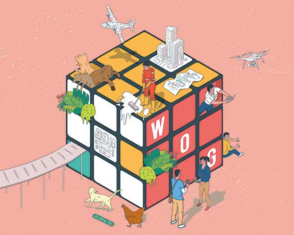
Changing weather patterns, more flights and drones in the sky, the upkeep of our urban and natural environments… Public officers today handle more complex problems and have to do that without pumping up manpower. Meeting these challenges requires public agencies to work together and across boundaries by default.
As agencies learn to do more work across silos, instances of service delivery mishaps have made headlines. Earlier this year, when several municipal agencies could not resolve issues in building and safety requirements, residents in Khatib found themselves running short of sheltered walkways.
Despite such hiccups, many successful inter-agency projects show how Singapore benefits when public agencies do work well together.
Take a project to map all of Singapore in 3D, spearheaded by the Singapore Land Authority (SLA). Collaborating with various agencies to collect data from the ground and the air, the SLA produced a high-resolution 3D map of Singapore and datasets to help agencies push out public services and better plan facilities and infrastructure for citizens.
Identify common needs
When the project started in 2013, two of the 11 agencies approached by the SLA gave strong support because they saw the need for 3D data, said Dr Victor Khoo, Senior Deputy Director (Land Survey Division) at the SLA.
The two agencies – national water agency PUB and the Civil Aviation Authority of Singapore (CAAS) – entered into agreements with the SLA that covered the strategic objectives of creating a highly accurate 3D map to meet their requirements.
The project team, including representatives from the Ministry of Home Affairs and the Ministry of Defence (MINDEF), also had to agree on technical and security details. This was to ensure that the datasets could be expanded for future whole-of-government (WOG) uses.
“At the working level, because we needed the project to be completed on time, everybody put in their 100% effort,” Dr Khoo said.
A major challenge was capturing the aerial images and data within time and airspace constraints. To collect airborne image data, two planes fitted with a five-lens camera and a laser scanner flew over Singapore multiple times. The planes could only fly with clearance from the CAAS and MINDEF. One plane would capture images in the daytime while another would 3D-scan the landscape at night, all within a 40-day time frame. The actual window of opportunity to do so, however, proved narrower because of low cloud cover and a busy airspace.
“We met once every few days to review the flying schedule and day-to-day issues to capture the data within the contracted time frame,” said Dr Khoo.
Meanwhile, a vehicle mounted with a 360-degree camera and laser scanners collected street-level details such as bridges, roads and tunnels. It covered 5,500km across Singapore.
The PUB uses the digital terrain models for drainage planning and investigating floods to make Singapore more climate resilient and reduce disruptions to everyday life. The CAAS uses the 3D building models to design flight paths, keep Singapore’s airspace safe and fulfil international civil aviation requirements.
Other agencies such as the Building and Construction Authority (BCA), Urban Redevelopment Authority (URA), Housing & Development Board (HDB), National Parks Board (NParks) and JTC Corporation use the data in various ways. For example, the data helps the URA and HDB plan public housing that is shaded from strong sunlight, requiring less air-conditioning, while increasing the potential for tapping solar energy on rooftops.
Consolidating the agencies’ requirements for one 3D map has nearly halved operating costs, compared to each agency developing its own map. For its principle of “develop once to benefit many”, the project won the Best Practice Award (Inter-Agency Collaboration) at the 2016 Excellence in Public Service Awards.
.jpg)
Establish communication early
Over at Coney Island, unknown to many visitors, the environment has been kept spick and span for them by one vendor and many public agencies working together.
While NParks manages Coney Island, the National Environment Agency (NEA) maintains cleanliness through its appointed vendor, Chye Thiam Maintenance.
Early collaboration between all parties was key before the handing over of responsibilities, said Mr Panirselvam Kasinathan, Senior Manager (Performance & Management) at the Department of Public Cleanliness of the NEA.
The discussions, joint site inspections and assessments of the cleaning operations started as early as May 2015 – five months ahead of the island’s opening.
Unlike urban areas that the team was used to taking care of, Coney Island presented different challenges: wild boars, monkeys, stray dogs, pythons and even a free-roaming Brahman bull. This called for risk assessment to protect the cleaning team’s safety, and workers to be familiarised with the island’s rich flora and fauna to tailor a cleaning regime for the island.

Know who to call
Following the handover of cleaning maintenance to the NEA and Chye Thiam Maintenance, both NParks and the NEA kept communication channels open for continuous monitoring and assessment. This proved crucial after the handover.
Just before a VIPs’ visit in January 2016, a white, foamy substance first found at sea hit the Coney Island shoreline. The NEA team, alerted by the Agri-Food & Veterinary Authority (AVA), worked through the weekend to clean up the foam so as not to disappoint the visitors.
A year later, a major oil spill of 300 tonnes happened after two ships collided at night in the Straits of Johor. Working with the Maritime and Port Authority to get the trajectory of the moving oil spill, the NEA team assessed that most of Singapore’s shorelines in the northeast, including the beaches of Coney Island, would be affected.
It was important to act quickly to protect marine life as the affected areas are rich in biodiversity. But safety was of paramount concern. It was not possible to carry out cleaning operations throughout the night. “After careful assessment, we planned and executed cleaning of the affected shorelines at first light,” said Mr Panirselvam.
For WOG efforts to run well, he suggested planning and identifying contact points early to ensure that relevant information reaches the right agencies.
Inter-agency collaboration was again needed when the bull on Coney Island died in September 2016. At NParks’ request, the NEA team, along with the AVA, moved to help dispose of the carcass. “A lot of effort and coordination went into this to settle this incident swiftly,” said Mr Panirselvam.
Having good bosses with domain expertise also helps, he said. Whenever the team faces a dilemma or operational challenges on the ground, the officers turn to their immediate supervisor, Deputy Director Ravindran Nair. “He is a good reference point on facts pertaining to public health and cleaning, after almost four decades of working experience in the public health field.”
Another supporter is Director Tai Ji Choong, who is “always willing to take a courageous stand on differences”.
Besides sharing expertise across roles and responsibilities, Mr Panirselvam suggests that shared technologies can further enable agencies to work well with one another. These include sensors, smart devices and CCTVs to send relevant data to a central database supporting the respective operations of agencies.
Easy access to business data

The Enterprise Data Hub (EDH) is an inter-agency data-sharing platform that provides public officers with easy access to verified, identifiable business data. You can use it to verify the legitimacy of a business, learn about a company’s profile and the government support it has received, and cross-reference agency data with datasets on the EDH for new insights. Currently, datasets from the Ministry of Manpower, Inland Revenue Authority of Singapore, Accounting and Corporate Regulatory Authority, and Central Provident Fund Board are available. The EDH is accessible on your Government Standard Image Build (GSIB) and GoMax devices.
To learn more, contact GovTech-edh@tech.gov.sg or go to edh.gov.sg
Find common platforms
For public agencies looking to use drones in their operations, GeoSpace is another WOG geospatial platform by the SLA. It allows agencies to coordinate their drone operations and share the data captured.
For example, a public agency wanting to perform a drone inspection over a construction site can indicate their intent on GeoSpace. A notification is sent to other agencies interested in the same site, so multiple agencies can tap the data collected from a single drone flight, removing the need for repeat flights and improving the efficiency of inspection operations.
The government-wide platform also allows agencies to have online discussions on the area of drone operations, as well as share images and flight routes. That means public agencies can do away with sending emails back and forth just to arrange for an inspection.
And with a variety of captured data such as photographs, videos and 3D images, GeoSpace can also be used for post-flight analysis after a drone is used.
But in encouraging the use of drones, there was the need to strike a balance between economic and security considerations. While drones are more efficient as they reduce reliance on manpower, they have also raised concerns about personal privacy.
.jpg)
Bring everyone together
The Unmanned Aircraft Systems (UAS) Committee, led by the Ministry of Transport (MOT), brings together public agencies that are exploring the use of drones.
The committee includes regulators (the CAAS), security agencies (e.g., Singapore Police Force), economic agencies such as the Economic Development Board (EDB), and other agencies such as the URA, NEA, SLA and PUB.
Mr Pang Kin Keong, then-MOT Permanent Secretary and UAS Committee Chairman, said in a February 2016 press release: “We want to facilitate [the use of drones] by industry and the public sector, and also hobbyists, but we must at the same time balance against aviation safety, public safety, security and privacy concerns.”
See another point of view
Helping these agencies see one another’s points of view is the Innovation Lab in the Public Service Division (PSD)’s Transformation Office. Its main work is design thinking and user research for public service innovation.
The CAAS had initially approached the Lab to explore how to bring design thinking elements into a brainstorming workshop for drones.
But the real challenge, the Lab discovered, was that the agencies involved had “opposing views on how drones should be used”, said Mr Alexander Lau, Principal Design Lead at the Lab. “The bigger issue was that they didn’t know the areas of use that both sides could support.”
With that understanding, the Lab redesigned the workshop, and in April 2015, officers from the CAAS, the Police and other agencies, including the then-Infocomm Development Authority of Singapore and NParks, came together. The workshop sought to highlight the different points of views, “and let the participants come to some sort of consensus and find the principles of what they can and cannot support”, said Mr Lau.
Inter-agency committees for autonomous vehicles and drones
.jpg)
Other than the UAS Committee, the MOT also leads the Committee on Autonomous Road Transport for Singapore, or CARTS.
Mr Pang, who also headed CARTS, said in an Upfront video on Workplace: “We brought together not just the regulators, whose concerns we had to deal with, but also the agencies, who could potentially benefit from the application of AVs and drones … in the normal course of their work.”
With these committees, the aim is also to “show all the participating agencies the larger picture to expose them to the immense potential and possibilities that these emerging technologies could bring”.
Watch the video at: bit.ly/upfront-pspang1
More work ahead
As for the SLA’s 3D map, work continues with on-going efforts to maintain the datasets and engage agencies on their evolving requirements for new uses of the map. Going forward, Dr Khoo is undaunted by the need to coordinate between more agencies to further expand the datasets – all that is needed is a bit more time to talk through issues.
“I’ve always known that officers in different agencies ultimately understand the WOG working principles,” he said. “Even though they may have different interests and priorities, when it comes to the need to get things done, they will come together to prioritise interests and overcome issues.”
- POSTED ON
Oct 7, 2017
- TEXT BY
Lynda Hong
- ILLUSTRATION BY
Mushroomhead
-
Deep Dive
Strengthening Singapore’s Food Security
-
Profile
Looking Out For All





.tmb-tmb450x250.jpg)